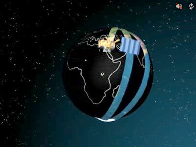
Polar orbits are a fascinating aspect of space
technology, providing unique opportunities for observation, communication, and
scientific research. In this detailed exploration, we dive into the intricacies
of polar orbits, their applications, and how they shape our understanding of
Earth and beyond.
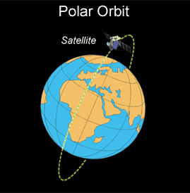
What is a Polar Orbit?
A polar orbit is a type of satellite orbit that passes over Earth’s poles, allowing the satellite to travel in a north-south direction around the planet. As the Earth rotates underneath, this orbit provides coverage of the entire globe over time. Polar orbits typically have an inclination close to 90 degrees relative to the equator. This makes them ideal for Earth observation, weather monitoring, and reconnaissance, as they allow satellites to capture data and images of the entire planet with high temporal resolution. Satellites in polar orbits usually maintain an altitude between 500 and 1,000 kilometers, balancing detailed imaging with coverage. One specific type of polar orbit is the Sun-synchronous orbit, where the satellite crosses the equator at the same local solar time on each pass, ensuring consistent lighting conditions for observations. These orbits are commonly used for scientific research, environmental monitoring, and military surveillance, offering a comprehensive and periodic view of Earth’s surface.
Applications of Polar Orbits
1. Earth Observation:
- Weather Forecasting: Satellites like NOAA’s POES
(Polar-orbiting Operational Environmental Satellites) provide detailed
weather data, helping in accurate weather predictions. - Environmental Monitoring: Polar orbits enable the
monitoring of global climate changes, including ice cap melting and
deforestation.
2. Scientific Research:
- Geological
Studies: By observing the Earth’s surface
over time, scientists can track geological changes like erosion or
volcanic activity. - Atmospheric
Research: Studying the atmosphere’s
composition and changes, such as ozone layer depletion, is made possible
through these orbits.
3. Military and Surveillance:
- Reconnaissance:
Polar orbits allow for comprehensive coverage, which is vital for military
intelligence and surveillance operations.
4. Telecommunications:
- Global
Coverage: While not as commonly used for
telecommunications as geostationary orbits, polar orbits can support
global communication networks, especially in polar regions.
First Polar Orbit Satellite
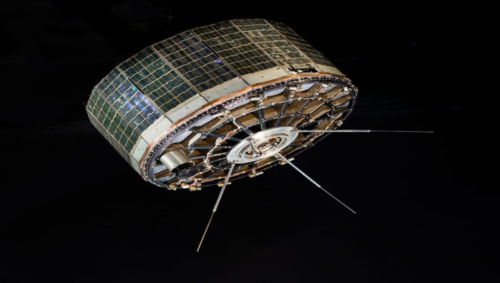
This image showcases the historic TIROS-1 satellite
The first satellite to be placed in a near-polar orbit was TIROS-1 (Television Infrared Observation Satellite), launched by NASA on April 1, 1960. This pioneering satellite was pivotal in demonstrating the potential of polar orbits for Earth observation. Orbiting at an altitude of about 650 kilometers and with an inclination of 48.4 degrees, while not truly polar, TIROS-1’s orbit was close enough to cover a significant portion of the Earth’s surface, including polar regions, which was revolutionary at the time. It carried two television cameras and sensors to capture the first weather images from space, transmitting back over 22,000 images during its operational life. These images provided meteorologists with unprecedented views of cloud patterns, storm systems, and even the first pictures of Earth from space, fundamentally changing weather forecasting by introducing the era of satellite meteorology. TIROS-1’s success laid the groundwork for the development of more sophisticated polar orbiting
The Polar Operational Environmental Satellite (POES)
The Polar Operational Environmental Satellite (POES) program, managed by the National Oceanic and Atmospheric Administration (NOAA), has been a cornerstone in global weather and environmental monitoring since its inception. The journey began with the launch of TIROS-N on October 13, 1978, marking the official start of the POES constellation with its advanced capabilities for weather observation from polar orbits. This satellite introduced the Advanced Very High Resolution Radiometer (AVHRR), which became a staple for subsequent POES satellites for its multi-spectral imaging capabilities.
Following TIROS-N, NOAA-6 was launched on June 27, 1979, enhancing the series’ meteorological data collection with the addition of the TIROS Operational Vertical Sounder (TOVS) suite for atmospheric profiling. The 1980s saw further advancements with satellites like NOAA-8, launched on March 28, 1983, which was the first of the Advanced TIROS-N (ATN) series, featuring improved and additional instruments for more precise data acquisition.
A significant leap in the POES program occurred with NOAA-15, launched on May 13, 1998, introducing the Advanced Microwave Sounding Unit (AMSU) for enhanced atmospheric sounding. This satellite also carried the Space Environment Monitor (SEM) for space weather monitoring, indicating NOAA’s expanded focus on understanding the space environment’s impact on Earth.
The series continued with NOAA-16 on September 21, 2000, and NOAA-17 on June 24, 2002, each contributing to the growing database of Earth observation data. NOAA-18, launched on May 20, 2005, and NOAA-19, which took to the skies on February 6, 2009, were the last in the POES series, providing critical weather forecasts, climate data, and support for emergency services through the Search and Rescue Satellite-Aided Tracking (SARSAT) system.
These satellites have orbited at approximately 850 kilometers with near-polar orbits, offering global coverage by passing over the poles and crossing the equator at consistent local solar times. This sun-synchronous orbit has been essential for daily imaging with consistent lighting conditions. The POES program has been vital for short-term weather forecasts, long-term climate research, and global environmental monitoring, with each satellite contributing to an ever-expanding archive of Earth observation data.
As NOAA transitions from POES to the more advanced Joint Polar Satellite System (JPSS), starting with Suomi NPP in 2011 and NOAA-20 (JPSS-1) in 2017, the legacy of POES continues through the invaluable historical data sets that inform our understanding of Earth’s dynamic environment. The history and contributions of the POES program are detailed in numerous NOAA publications and NASA’s Goddard Space Flight Center documentation, ensuring a verified record of this significant chapter in environmental satellite technology.
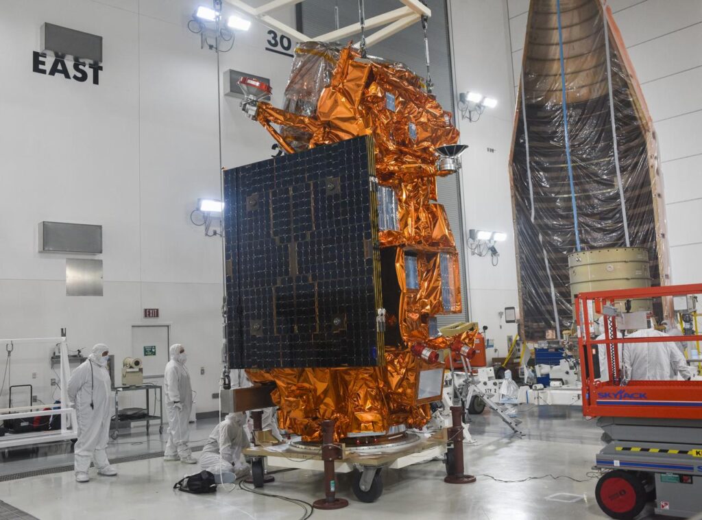
Image Details (Credit:NASA) Technicians prepare the National Oceanic and Atmospheric Administration’s Joint Polar Satellite System (JPSS-2) to be attached to its spacecraft adapter inside the Astrotech Space Operations facility at Vandenberg Space Force Base (VSFB) in California on Oct. 4, 2022
The MetOp Series
The MetOp Series, developed through a joint initiative by the European Space Agency (ESA) and EUMETSAT, has significantly enhanced global meteorological and environmental monitoring. With satellites MetOp-A launched on October 19, 2006, MetOp-B on September 17, 2012, and MetOp-C on November 7, 2018, this series orbits at approximately 817 kilometers in a sun-synchronous polar configuration. A key aspect of the MetOp program is the cooperative agreement with NASA, where NASA provides several instruments for the MetOp satellites, including the Advanced Microwave Sounding Unit-A (AMSU-A1 and AMSU-A2) and the High-resolution Infrared Radiation Sounder (HIRS/4). This collaboration, formalized under the Initial Joint Polar System (IJPS) agreement between EUMETSAT and NOAA, with NASA’s involvement, ensures that data from these instruments are shared, benefiting both European and American meteorological services. The MetOp satellites carry a diverse array of tools like the Infrared Atmospheric Sounding Interferometer (IASI) for atmospheric profiling, the Advanced Very High Resolution Radiometer (AVHRR/3) for imaging, and the Microwave Humidity Sounder (MHS) for moisture analysis. Additionally, they support global ozone monitoring with the Global Ozone Monitoring Experiment-2 (GOME-2) and contribute to search and rescue operations. This partnership not only enhances the quality and reach of weather and climate data but also exemplifies international cooperation in space science, with details of the NASA agreement and contributions well-documented by EUMETSAT, ESA, and NASA’s official reports.
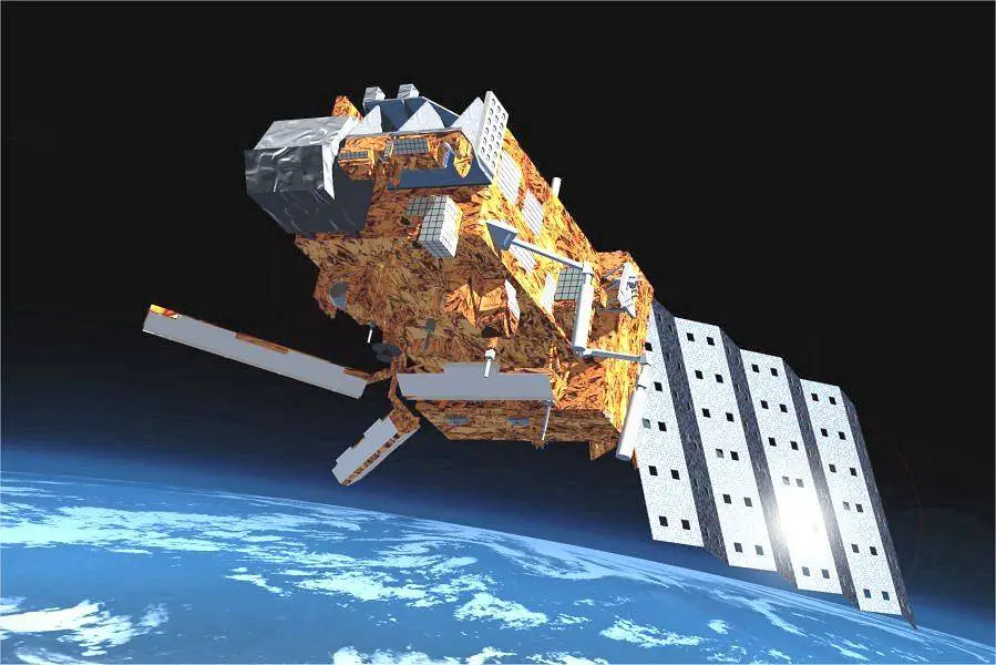
MetOp-A is Europe’s first polar orbiting satellite dedicated to meteorology. (Image Credit: NASA)